


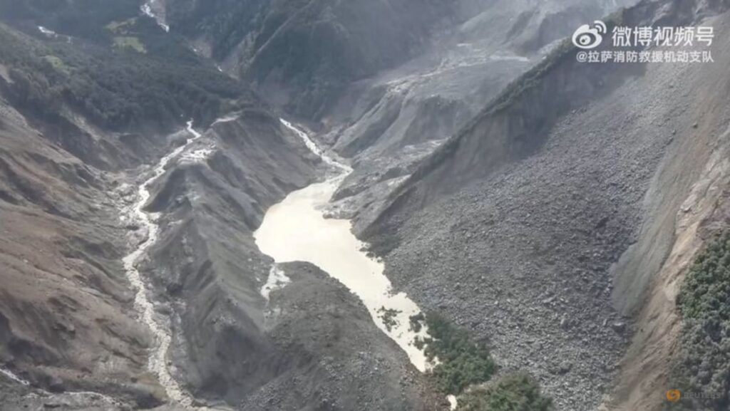
Experts and authorities have warned of the extremely high risk of secondary disasters in the valley, especially from the lake that was formed by glacier debris, potentially endangering rescue operations downstream.
State-owned engineering and rescue enterprise China Anneng, which has been monitoring the lake since Thursday, dispatched a 15-member team on Friday with reconnaissance drones, portable satellite stations and mobile surveillance cameras to gather more data about the lake.
An overflow from the lake on Friday temporarily halted rescue work before further assessment deemed the risks manageable.
Authorities have also flagged another larger body of water at the bottom of the glacier collapse.
“We estimate its area to be over 120,000 square meters, but its depth is currently unknown,” said Chen Hongqi, a senior engineer at the Ministry of Natural Resources’ Geological Disaster Technical Guidance Center.
Flood risks will remain until the two lakes have fully drained, an official with Nepal’s Disaster Management Authority has said.