


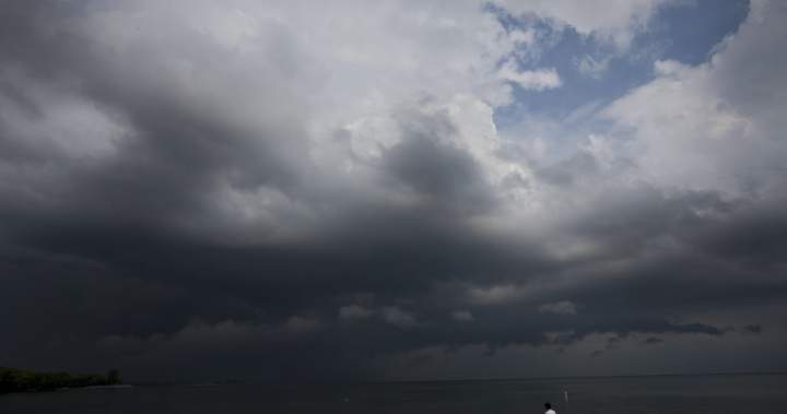
As heat waves blanket parts of Canada, experts say the extreme heat and humidity can also “fuel” severe thunderstorms — and even tornadoes.

Heat waves are becoming more frequent and intense in Canada, which increases the risk of these dangerous storms.
One of those storms hit the Prairies over the weekend, with tornadoes reported in parts of Saskatchewan after a humid heat wave.
“We often get really bad thunderstorms, usually in the afternoons, during these periods of extreme heat, especially with the humidity,” says atmospheric physics professor Kent Moore at the University of Toronto.
“If they’re really severe thunderstorms, one can get tornadoes developing as well. So, there’s the possibility that you’ll get a tornadic thunderstorm during a heat wave.”
Several provinces were sent alerts Tuesday by Environment Canada, including parts of Ontario, Quebec and Manitoba, with temperatures ranging from 30 to 40 C with the humidex.
Summer typically brings warmer temperatures, but climate change, or global warming, is making peak temperatures higher than they should otherwise be.
“The extreme heat we’re seeing today is twice as likely because of the effect of global warming,” says Moore. “We’re probably maybe two to three degrees warmer than we would have been without global warming.”
Environment Canada defines extreme heat events, or heat waves, as two or more consecutive days where daily temperatures have reached heat warning thresholds with no relief overnight.
It adds that these heat events “are one of the known impacts of climate change.”
Moore says heat waves are typically caused by high-pressure systems in the atmosphere that compress and warms air downward, while also drawing in humidity from regions like the Gulf of Mexico.
The combination of intense heat and moisture in the atmosphere creates not only heat waves, but also ideal conditions for thunderstorms to develop.
Related Videos

Global News meteorologist Anthony Farnell says this particular heat wave can be classified as a “heat dome.”

Get breaking National news
Get breaking Canada news delivered to your inbox as it happens so you won’t miss a trending story.
“A heat dome is the equivalent of putting a lid on a boiling pot of water. It traps in the heat (in this case from solar radiation) and feeds back on itself day after day until the dome breaks down,” he says.
“Severe thunderstorms are also likely to form around the ‘ring of fire’ surrounding the heat dome.”
From heat waves to tornadoes
Heat doesn’t directly cause tornadoes, Moore says, but warmer air holds more water vapour, which powers thunderstorms.
“When it’s hotter, the atmosphere can hold more water vapour, and water vapour is like fuel for the atmosphere,” he says.
“Most weather systems are driven by essentially the energy that’s released when water vapour condenses from its gaseous form to its liquid form.”
Environment Canada says that thunderstorms “can create very strong winds, hail, heavy rain, and sometimes even tornadoes.”
“Tornadoes can produce some of the highest wind speeds on the planet. Most Canadian tornadoes have maximum wind speeds under 180 km/h, but they can still cause serious damage.”
These storms can not only bring tornadoes but also cause flooding as a result of heavy rain.
Flooding severely impacted parts of the Prairies, Montreal and Ottawa in recent weeks, which followed intense rain during storms that ripped through communities and city centres.
Are tornadoes becoming more frequent?
Although extreme weather events are becoming more frequent and severe in nature, tornadoes remain extremely difficult to forecast and document.
“We don’t get a lot of warning about severe thunderstorms,” says Moore. “Maybe as they’re starting to develop, Environment Canada will issue warnings, but they’re much more difficult to forecast. And tornadoes are essentially, I think, still unforecastable.”
Environment Canada says it is able to issue alerts and warnings, including for tornadoes, but those warnings could come with less than 30 minutes’ notice.

It may be difficult to predict when and where tornadoes will form, but storm and tornado tracking is improving.
David Sills is the director of the Northern Tornadoes Project at Western University’s Canadian Severe Storms Lab, as well as a former weather scientist at Environment Canada.
In a statement to Global News, Sills says his research team at the Northern Tornadoes Project has been compiling data since 2017, and they have been able to nearly double the 30-year average number of tornadoes documented across Canada on a regular basis.
Sills says the long-term data doesn’t show as much of an increase in tornado frequency in the Prairies as there is in Ontario and Quebec, but more recently, Sills says there has been a noticeable change.
“The year-to-year variation in tornado counts is quite high on a regional basis. This year it is the Prairies that seem locked into a stormy weather pattern and have had repeated tornadoes. But it could be the opposite next year.”
Storms, and tornadoes that can come with them, are more common in the geographic region of North America commonly referred to as “Tornado Alley,” and parts of Canada lie along that corridor.
“Tornado Alley, which kind of goes up through Oklahoma, up through Kansas, up towards Michigan, is kind of the way that most tornadoes form. Ontario is at the tail end of that Tornado Alley,” says Moore.
“We’re now getting more thunderstorms in the West as well. So Alberta, Saskatchewan, Manitoba, also are getting more tornadoes. And again, that’s just mostly because the thunderstorms are just more active now than they used to be.”

